October 31, 2014
Redding Living
We began our Redding Living with
bright blue skies and temperatures in the low 70's, a welcome respite
after spending our last few days in Oregon in rain, clouds and fog.
The weather began to clear the
morning we left Grants Pass, heading south over Siskiyou Pass towards
northern California.
We spent the first afternoon setting
up the coach, and then making a grocery run. It was nice to be close
to shopping again after spending a month "18 miles from Walmart"
(RVers gauge for how close a campground is from shopping facilities).
The next morning was cleaning time.
We track in a lot when we're breaking down and setting up. We also
get a lot of dust when we leave windows open, which we were able to
do in Oregon, so it was time for a good sprucing up.
With the "house" clean and
Jo's sewing corner set up and ready, it was time to check out what
was around our new "home place".
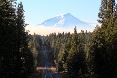
Naturally we were drawn back up the
road a little ways to Mt Shasta, the dominate mountain in the Redding
area we had seen on the way in. We picked out a route that took us
east, then north to Mt Shasta and back to Redding, about a 140 mile
loop. We made a short side trip to Moose Camp, a private camp on the
way to Burney where we would turn back to the west.
We found some
great fall color and the brightest red maple either of us had ever
seen. See Jo's pics on her Pinterest page ( http://www.pinterest.com/jimcope/
) .
Driving up and down on beautiful
mountain roads, we finally turned west again at Burney toward Mt.
Shasta.
We stopped at a great waterfall.
Then on towards the
mountain. Our first view from this direction, the mountain was
shrouded with smoke at the it's base from controlled burns by the
forest service.
After passing through the burn area, the mountain
came into view again, minus the smoke. It was a little tricky
finding good vantage points along the heavily forested highway, until
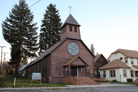
we came into the small town of McCloud.
This quaint picturesque
little town is dominated by it's view of Mt Shasta. After taking a
few shots, not only of the mountain, but also of the town itself, we
moved on towards Shasta City, and the interstate back to Redding.
On the way we took a side road to the
right, driving up as far as we could toward a ski resort which was
still closed before season opening. Snow down to 4000 feet is in the
forecast in a couple of days, so opening of the ski area could come
soon. The road gave us several views of Mt Shasta with reflected sun
from the sunset.
It was getting dark when we made it
back to Shasta City and it's pretty neighborhoods, so we will have to
make a return trip there.
The next day was spent with Jo
tweaking her sewing center and editing photos, while I worked on
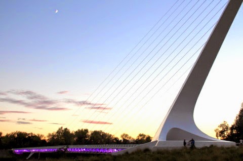
writing a few pages for the website. At the end of the day, needing
to get out, we drove a couple of miles to the Redding Sundial Bridge,
where we walked and took more photos.
We aren't sure whether the
bridge is a marvel in architecture, engineering or art, but it has
elements of all three and is beautiful. The grounds around the
bridge spanning the Sacramento River, are perfect for a stroll.
We had decided to spend another day
at home the next day, but with rain in the forecast , (snow in the
higher elevations) we decided to try to make one more little side
trip, this one to Whiskeytown Recreation area. It's a nice forested
area just a few miles west of Redding. We stopped at a picnic table
as we drove around the lake and had lunch.
Then we continued the
drive around the lake through large forests, along a stream, and
across open hills covered with Manzanita shrubs.
Jo found a forest
service road that took us past some great views of Whiskeytown lake.
We arrived back home at dusk and enjoyed a great "leftovers"
dinner.
Redding sits in a valley surrounded
by the Coastal mountains to the west, the Cascades to the north, and
the Sierra Nevada range to the east. We are starting to feel "right
at home", and it's only been a few days. It is a blessing to be
able to live here for awhile.


No comments:
Post a Comment