Sunday, January 18, 2015

Driving the Apache Trail

The Apache Trail


The Apache Trail, (named after the Apaches who first used it to traverse the Superstition mountains), became a Stagecoach Trail, that later became one of the first Arizona Highways. (Hwy 88)

By combining the Apache Trail itself, (which runs from Apache Junction just east of metro Phoenix to the Roosevelt Lake Dam), with Highway 188, Hwy 60 and Hwy 79, you can make a loop that is about 150 miles in length,  runs through Arizona mountains and desert, and is very scenic.  


We chose to make the loop in a clockwise direction starting at Apache Junction. Tortilla Flat comes first, then it's on through the Superstition mountains, past Canyon Lake, Apache Lake, to Lake Theodore Roosevelt. 


The stretch from Apache Junction to Tortilla Flat is a paved road. From just past 
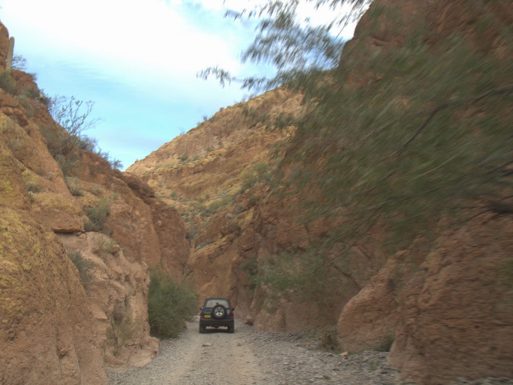
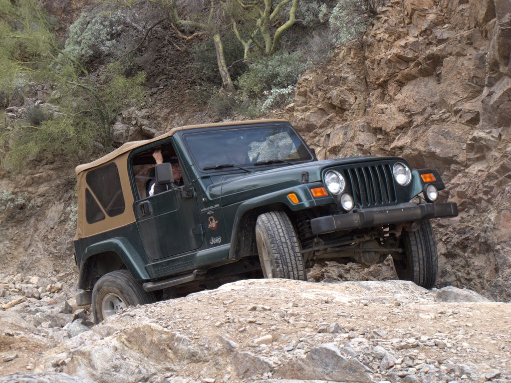
Tortilla Flat to Lake Theodore Roosevelt, the road is a dirt road. Although the dirt portion is narrow with lots of up and down mountain driving, the road is well graded, and has plenty of turnouts to meet oncoming cars. Some "flatlanders" might find it a little intimidating, but if you just simply pay attention to your driving, it will be an easy drive with scenery that is well worth the small effort. There are lots of places to stop, so the driver can also enjoy the views. No special vehicle is needed. Cars drive it all the time. (Just leave your RV at your base camp, due to the narrow tight turns.)


The first part of the drive winds through desert settings, climbing through the superstition mountains 
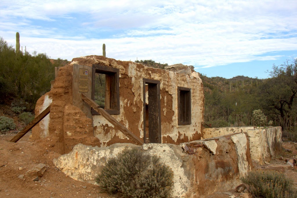
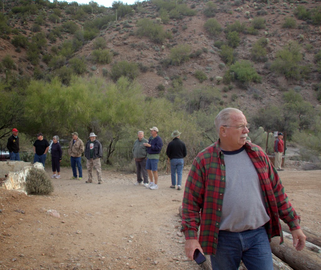
to Tortilla Flat, an old west remnant with a restaurant/saloon, merchantile / gift store, and an old country store. Walk down the boardwalk to the Superstition saloon where you can sit on a real saddle for a bar stool, and have your favorite brew or a sarsaparilla.


The road turns to dirt shortly past Tortilla Flat, and offers abundant views of canyons, mountains, and cactus. 


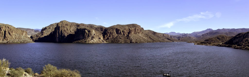
Canyon Lake appears as you descend one of the downgrades, surrounded by large jagged rocks. 


This area is, as is most of the drive, part of the Tonto National Forest. A nice recreation area along the shore of the lake offers picnic facilities, boat launches, and shelters. (subject to US passes and fees.)


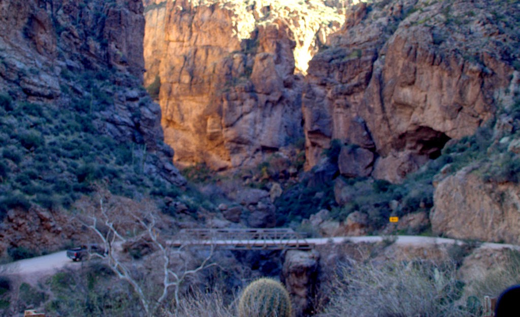
The road from Canyon Lake to Apache Lake is the most scenic portion, with the road winding deep into a canyon. Sharp turns between the rocky escarpments open into incredible vistas, revealing the steep sidewalls of the canyon, and the winding road on which you are traveling below. There are several turnouts where you can stop for pictures.


A little further along, the road ascends again and passes Apache Lake, a long narrow lake formed by canyons between the mountains. There are also recreation areas, campgrounds, etc along here.
Apache Lake runs for miles along this stretch giving many spectacular views and opportunities for photos.


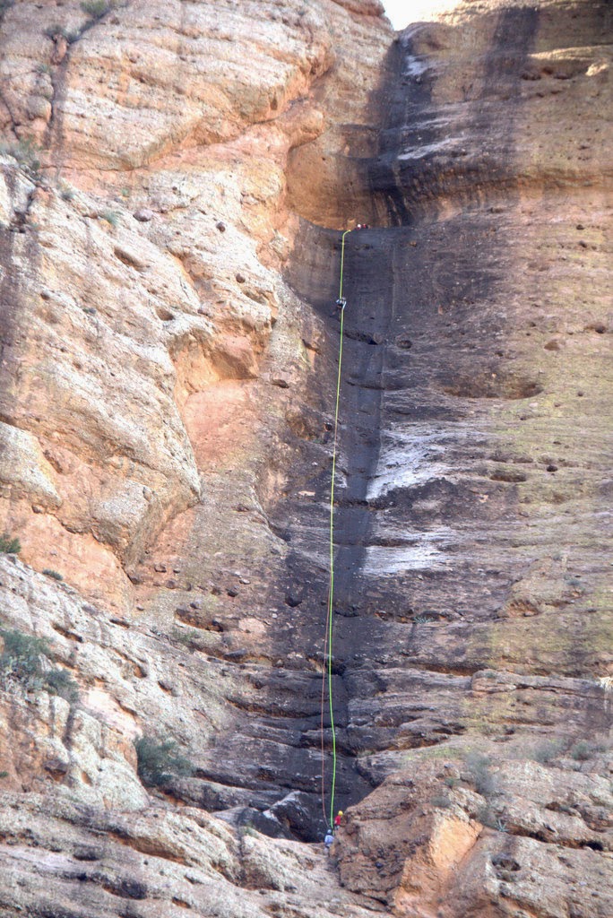
Rappellers Descending the Cliff


Eventually the road makes a turn revealing Theodore Roosevelt Dam. As the road climbs to the top of the dam, you get your first view of the Lake Roosevelt, a large sprawling lake with mountains surrounding.


A right turn onto Highway 188 takes you into rolling hills and a lot faster driving. A short distance from the dam, a right turn takes you on a nice short side trip to an area where you find cliff dwellings.


Back on the road your route takes you across mountain passes and through miles and miles of desert cactus.  A right turn near Globe onto Highway 60, then further along,  another right turn onto Hwy 79 brings you back to finish your loop at Apache Junction.

We both were fascinated with this great drive. We expect to go back again before we leave here. The Arizona mountain scenery with it's tall Saguaro (Suh wah ro) Cactus is a delight to pass through.  It makes the mountains of Arizona like no others.


Thursday, January 8, 2015

Off Road to Box Canyon

January 8, 2014

Our Jeep trip started with a line up at the wood shop area of the resort where we met Steve, and 7 other Jeep loads of folks, all interested in driving to Box Canyon for the day. We had 7 Jeeps, a Toyota Cruiser, and a Isuzu in our little caravan.


Driving north on Hwy 79 toward Florence, we turned east toward the Box Canyon at about 8:30 am.  Shortly afterwards, our caravan was joined by a pickup towing a trailer with 2 "4-wheelers" who rode with us for part of our trip.


After turning off the paved road we "aired down" our tires to about 15 psi for easier riding and better traction. Some of us also disconnected our sway bars. ("The Rubicon" makes this easy. You just push a button on the dash. ) We then traveled our trail, stopping briefly for a potty stop, and to visit to an old Stage Stop, before entering Box Canyon.


The canyon started out about 50 yards wide, rapidly closing in on is as we traveled into it.

At one point the walls of the canyon rose almost straight up, and you felt like you

could almost spread your arms and touch both sides. (of course it was a little wider than that, unless you have really long arms). The walls showed sprinkles of green, yellow, reds, and oranges, subtle, but beautiful as we passed close to the strata in the rocks.  The trail through the narrows is mostly level, with just a couple of small boulders to climb over between the walls (an easy job for a Jeep).


Eventually the canyon began to widen again and the trail began to ascend with a few rocks, dips, and ruts to cross. The rating of the trail was about a "2" out of 5. (made into a 2.5 because of the falls area.)

After a short drive we arrived at the "falls" area, a gradual shelf about 10 to 12 feet high that can be easily climbed with good rear lockers. The  Isuzu and a couple of stock Jeeps needed a little tow from above to get past the center section. (Not that they both couldn't have made it, but nobody wanted to leave an axle behind today.)
Steve at the top directing traffic


Our "tail gunner" passed all of us on the rough, right side of the falls (making it look easy) in order to help with the towing. (He is one of the "Tail Gunners" for the more extreme Moab, UT tours during the summer months.)


It took less than 1/2 hour and we were all up. (Jo and I made it on our first attempt, thanks to our front and rear lockers - another 1 button push to engage) .


Steve our wagon master


From there it was a fairly easy "rocky road" to Granny's pass, where we stopped and viewed the many memorial head stones of people who had passed on and wanted their ashes released from that point.

The high point also gave us a spectacular view of the mountains to the west of the valley.


Then it was down again to the valley floor and a stop for lunch and some Jeeper talk. Then on back to the parking area near the Highway where we "aired up" for the trip home.


Today was a great day. We met some other fun and interesting Jeepers, laughed a

Jo "Documenting"
lot, and shared Jeep stories. Next trip will be to Walnut Canyon in a couple of weeks. We are starting to love Arizona.
                                                             (back to) RVing-LTD blog


Monday, January 5, 2015

I left my heart in.........

San Francisco

One of my room mates when I first went to college could sing, "I Left My Heart in San Francisco", in a deep baritone, and with such feeling, it would make Tony Bennett shed a tear. 


Aside from loving the song, there has been little over my vast number of years to draw me to the city....until I actually ended up there for the month of December 2014, and the Christmas season.


As I turned the curve on Highway 101 that brought the Golden Gate Bridge into view, I was awestruck. Add to that, the view of the city beyond the bridge , and I had to somehow wonder why it took so long to come here.  


I was not prepared for the grandeur and charm that awaited me within this incredible old city. 


The beautiful San Francisco Bay, the many bridges crossing into the city, the cable cars, the steep streets, 


the drive and the walks through Chinatown, 


not to mention the views of the city from atop Twin Peaks, all conspired to bring new meaning to the song, and the city that it is about.


I'm sure everyone that has visited San Francisco comes away with different impressions. These are some of the scenes that made memories for me. I hope you enjoy them.  

Views from Twin Peaks


Approaching City Hall Area


The Dickens Christmas Fair


Windmill in Golden Gate Park

A Great orientation Drive


One of the many Restaurants along Fisherman's Wharf


Palace of Fine Arts


Christmas Choir at Ferry Building


Listening intently to the "Dark" story of Alcatraz on the boat


Alcatraz Island (The Rock)
Dog Walker
Homes of San Francisco

Nighttime in San Francisco


We never tired of the night views